Mapping the Underworld of Wartime Beijing, 1937-1949
We are in the process of digitizing and georectifying historical maps of wartime Beijing (1937-1949). Relying on criminal case files and administrative records from the Beijing Municipal Archives, we attempt to pinpoint different types of buildings (taverns, theaters, restaurants, brothels, and drug dens) on the map and establish a database to store assorted archival information, including ownership, registered capital, opening date, capacity, and daily customers. By joining these points of interest with the attributes in this database, we aim at creating an interactive GIS map to explore the urban criminal underworld and informal economy in wartime Beijing.
The Spatial Humanities Working Group is a cohort of humanities scholars with a shared interest in geospatial technologies. Rather than formal presentations, these lab talks are designed to be engaged conversations about work in progress. They provide participants with an opportunity to share the possibilities and challenges of their projects as they take form, and to receive feedback from colleagues in a broad range of humanities fields. These gatherings do not require any formal background in computing. Sponsored by the Taylor Geospatial Institute’s “spacial humanities” initiative.
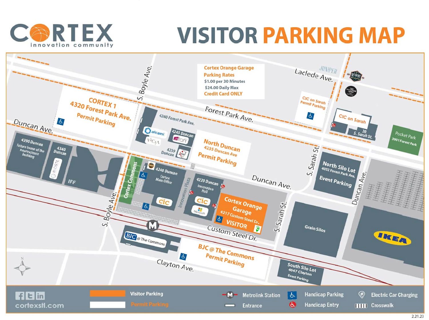
CORTEX is located at 4220 Duncan Ave. Park in the orange parking lot and enter through the connected building. See map for additional details. There will be parking passes for everyone who attends.